Manitoba Canada Lake Maps
Our Canada lake maps page is a resource for guests who have booked their Canadian fishing trip with Cobham River Lodge and want to get on the Walleye and Northern Pike quickly. We have owned and operated this system for over 40 years so we know where the fish are!
Cobham River Location Maps
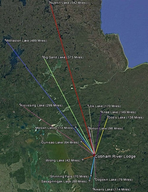
This section of maps will show you where Cobham River Lodge is located compared to other Manitoba fishing lodges. There are a lot of Manitoba fishing lodges who use cartoon maps on their site to try and make their location look farther North than they actually are. We don’t need to stretch the truth, here you can see exactly where we are looking at satellite imagery.
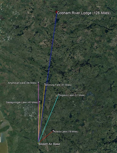
Bisett Departure Base
Cobham River Lodge Bissett, MB Departure map showing flight times to area lodges from Bissett, MB.
Manitoba Lodges Map
Cobham River Lodge location map showing location compared to other Manitoba Lodges
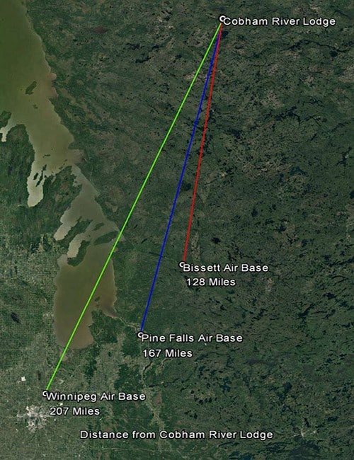
Cobham Departure Air Bases
Departure map showing location departure air bases to Cobham River Lodge
Cobham River Guide Maps
Our system is a unique system giving our fishermen the opportunity to fish two river systems, (The Paulson from the West and Cobham from the East). Both Rivers flow North just past our Lodge location all the way to Hudson Bay. We are the only Lodge on any of these Canada lake maps.
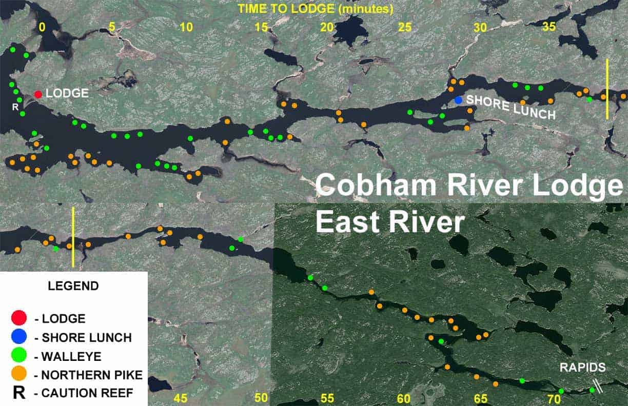
East River Guide Map
Cobham River (East) guide Canada lake map. This map details the waterways East of the Cobham River Lodge.
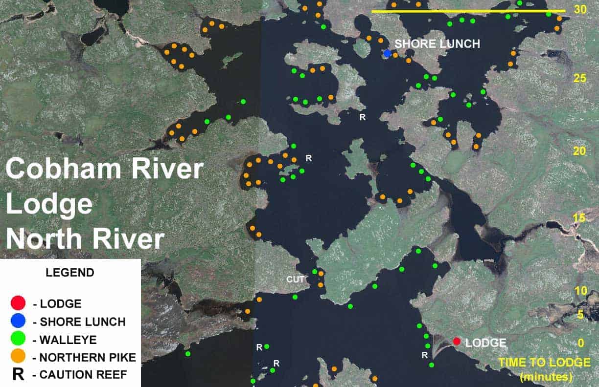
North (Segment 1) Guide Map
Cobham River (North Segment One) guide Canada lake map. This map details the waterways North of the Cobham River Lodge.
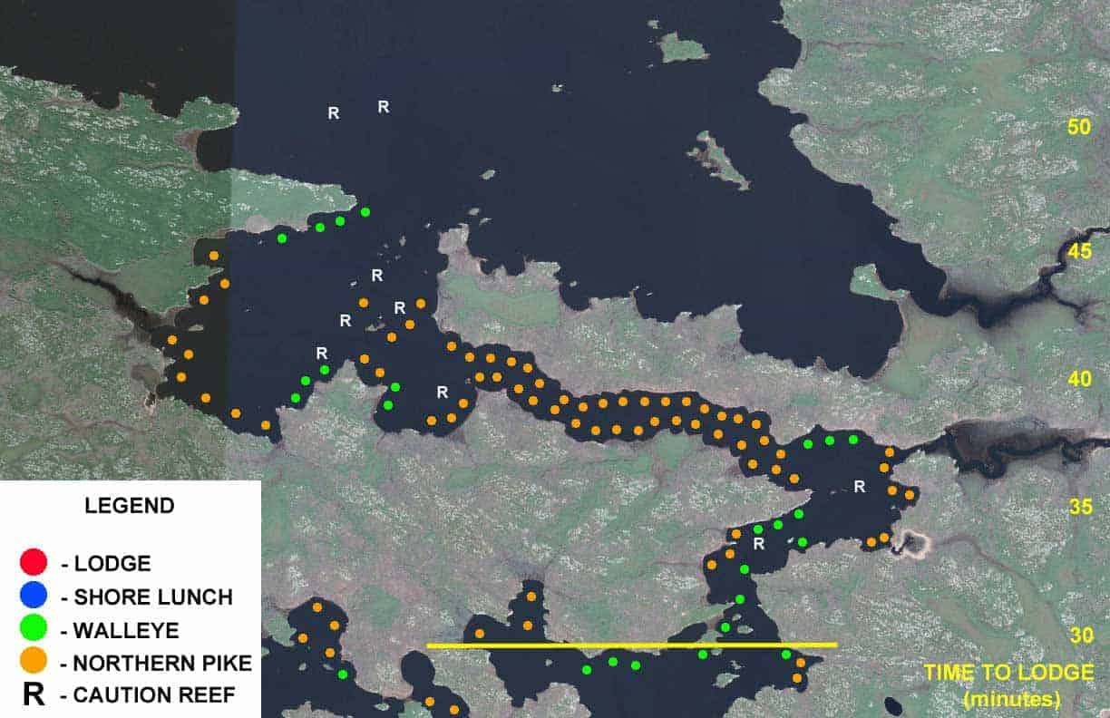
North (Segment 2) Guide Map
Cobham River (North Segment Two) guide Canada lake map. This map details the waterways North of the Cobham River Lodge.
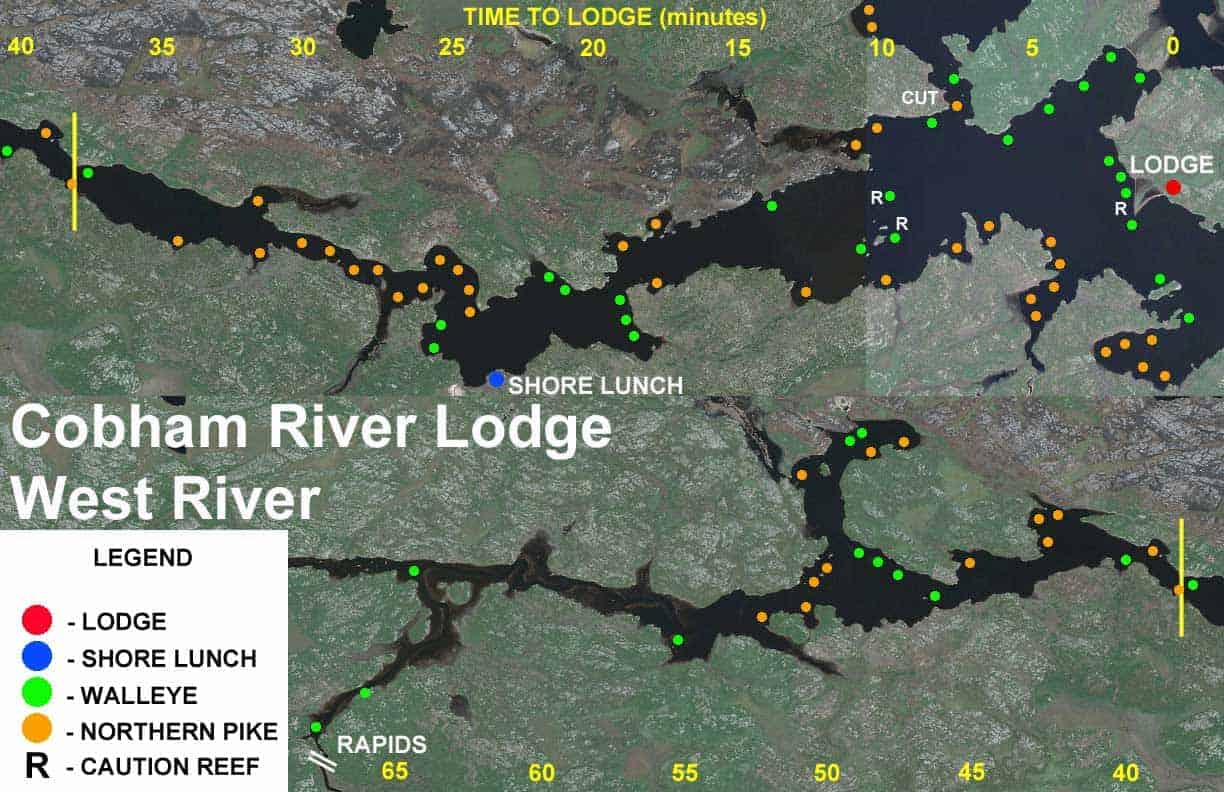
West River Guide Map
Cobham River (West) guide Canada lake map. This map details the waterways East of the Cobham River Lodge.
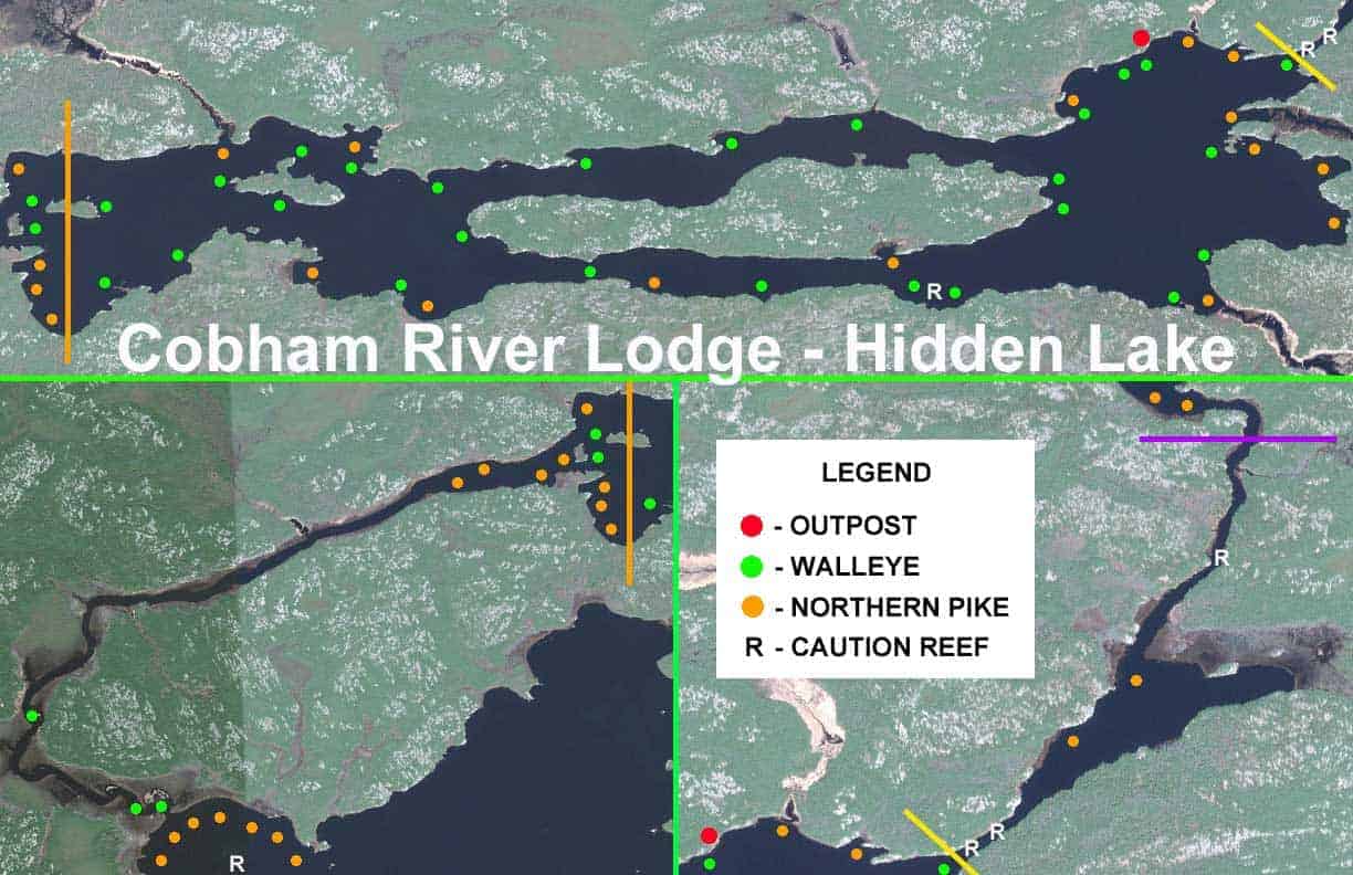
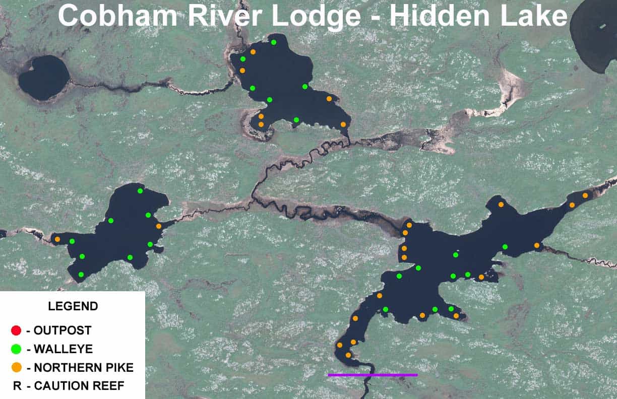
Hidden Lake Guide Map
Hidden Lake Outpost (Segment One) guide Canada lake map. This map details the waterways of Hidden Lake Outpost.
Hidden Lake North Lake Guide Map
Hidden Lake Outpost (Segment Two) guide Canada lake map. This map details the waterways of Hidden Lake Outpost.
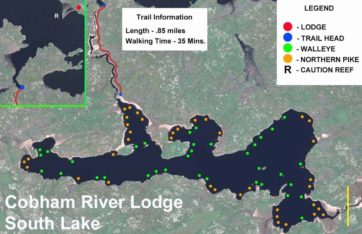
South Lake West Lake Guide Map
South Lake (Segment One) guide Canada lake map. This map details the waterways of South Lake.
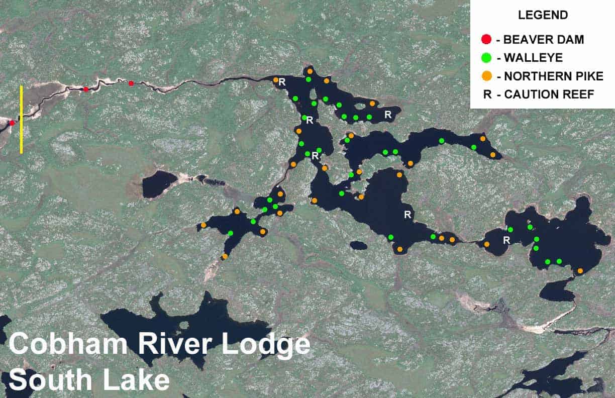
South Lake East Lake Guide Map
South Lake (Segment Two) guide Canada lake map. This map details the waterways of South Lake.
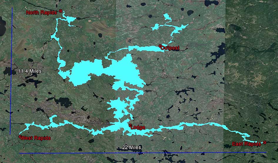
Cobham River Overview Map
Cobham River fisheries Canada lake map. Overview of the Cobham River fisheries.
Cobham River Sonar – Canada Lake Maps
Starting in 2016 we began the process of mapping the system with our sonar system. Every year we are able to map around 2-3000 acres. Another 20 years and we may have it done, but it’s a start! This map appears that everywhere is 12 feet deep, however if you zoom in it will show great detail using the + and – on the bottom left of the map. Enjoy!
Cobham River base maps for Lowrance/Humminbird (AT5 Files):
Lowrance/Humminbird Base Map (AT5 file format): Cobham River – Base Map (AT5) (1.009 G)
Note: Files are compressed in ZIP format shared via Google Drive
Cobham River Lodge Google Earth:
Cobham River Sonar – Google Earth (KMZ format): Cobham River Sonar – Google Earth (KMZ) (970 KB)
Cobham River Sonar Maps (AT5 Files):
C-MAP Genesis Social Map: Cobham River – Sonar Map (AT5)
Free online presentation of Cobham River data generated by the Lowrance, Simrad Yachting and B&G communities of fishing enthusiasts. Anyone with a Free Genesis subscription has unlimited access to the C-MAP Genesis Social Map and can export maps to your sonar.